Beinn Tulaichean
Beinn Tulaichean is at the southern end of the south ridge of Cruach Ardrain, and is not much more than its south top, the lowest point of the connecting ridge being about 820m
| Meaning: | Hill of Hillocks |
| Munro Region: | Loch Lomond to Loch Tay |
| Munro Number: | 217 |
| Height in Metres: | 946 |
| Height in Feet: | 3104 |
| OS Map Reference | OS Sheets 56 and 57; 416196 |
| Description: | Beinn Tulaichean is at the southern end of the south ridge of Cruach Ardrain, and is not much more than its south top, the lowest point of the connecting ridge being about 820m. On its east, south and west sides it falls in long and in places steep slopes, mostly grassy, but with some crags high up near the summit. The ascent of Beinn Tulaichean is usually made from the south-east, starting from the carpark at the end of the public road 1 kilometre east of Inverlochlarig. Walk along the private road to the farm and from there climb north-west up the long grassy slopes to the summit. This route is also a good way to Cruach Ardrain, continuing along the broad connecting ridge between the two hills. |
Ordnance Survey
OS Sheets 56 and 57;OS Grid Reference
416196Region
Stirling & Trossachs-

Pilot Panther Caravan
1950s showman's wagon that has been converted to make an unexpected and awesome glamping site. Lovely area of Scotland and very accessible for a few nights. Hotel is nearby for comforts. Sleeps 4
- Sleeps: 4
Other Cottages
-
Glenview Cottage Lochearnhead Sleeps 4-5
This detached holiday cottage has a lochside position beside the picturesque Lochearn. Glenview is ideal for boating pursuits and waterskiing, and offers access to a private slipway, jetty and mooring faci... -
Osprey View, Lochearnhead - Sleeps 8
This spacious house has stunning views across Loch Earn towards Ben Vorlich, and is within Scotland’s National Park. Water sports are plentiful with a local water sports centre/cafe within 5 minutes... -
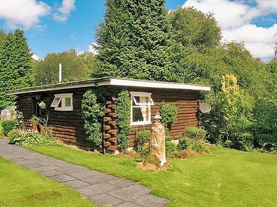
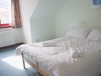
Loch Cabin, Lochearnhead, sleeps 4
A warm highland welcome awaits you at Loch Cabin, set in the lovely grounds of the owners’ 4 star guest house, the cabin has been equipped and furnished to ensure a comfortable and enjoyable holiday.... -
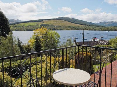
Lochside View, Lochearnhead - Sleeps 6
Located in a quiet area of the village of Lochearnhead, set in the heart of Loch Lomond and the Trossachs National Park, this detached holiday bungalow enjoys views across the waters of Loch Earn.
Print
Modification Date Thursday, 05 December 2013