Walking on Mull
Ben More Walk
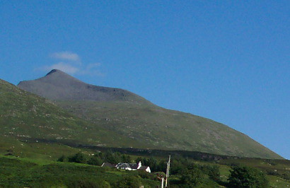
With the exception of the Cuillins on Skye, Mull's highest peak (3,169 ft) is the only Munro not on the mainland. The trail starts at a lay-by on the B8035, at Dishig, and is fairly clear, though it can be tricky near the top. Return the same way, or more experienced climbers could continue down the narrow ridge to the eastern summit, A'Chioch, then descend the eastern face to the road that skirts Loch Ba. The views from the top are magnificent, across the other Hebridean islands and even as far as Ireland. If it's a cloudy day, it's worth postponing the ascent until there's clear weather. Allow around six hours for the round trip.
Coastal walks
There are a couple of excellent coastal walks which start out from Carsaig Bay. A good path heads west along the shore to Carsaig Arches at Malcom's Point. The path runs below the cliffs out to the headland and then around it, and after about a mile reaches Nun's Cave, a wide and shallow cave where the nuns of Iona took refuge after being expelled during the Reformation. The path continues for another mile or so, but becomes a bit exposed in places and traverses a steep slope above a sheer drop into the sea. The famous arches are columnar basalts worn into fantastic shapes. One is a free-standing rock stack and another is a huge cave with two entrances. You'll need to allow about four hours in total plus some time at the arches.
Heading east from Carsaig Bay is a spectacular 4€-mile walk to Lochbuie, past Adnunan stack. It starts out through woodland, then follows the shore below the steep cliffs, with waterfalls plunging straight into the sea. It's easy at first but then gets very muddy in places and there's quite a bit of wading through boggy marsh, so make sure you've got good walking boots. Allow about five to six hours in total. A shorter walk takes you to the bronze age Lochbuie Stone Circle at the foot of Ben Buie. Leave your car at the stone bridge before you reach the village. Look for the green sign on the gate to your left and follow the white marker stones across the field. The stone circle is hidden behind a wall of rhododendrons, so follow the marker stones across the plank bridge until you see it. It takes about 30 minutes.
Forest walks
There are a few marked trails through Forestry Commission land on Mull. The first walk is to Aros Park, on the south side of Tobermory Bay. Start out from the car park near the distillery in Tobermory and follow the shoreline for about a mile to Lochan a'Ghurrabain, which is good for trout fishing. From here there is also a marked path around the loch (1 mile).
A longer walk is to Ardmore Bay, three miles north of Tobermory. The trail/cycle path starts at the car park by the road that runs northwest from Tobermory. From here, it runs out almost to Ardmore point and back again, passing a couple of ruined villages on the way. There's a good chance of seeing seals and lots of sea birds in Ardmore Bay. The trail is four miles in total.
Four miles north of Craignure is the car park and picnic site at Garmony Point, where a two-mile trail leads to the Ferry terminal at Fishnish, hugging the shore all the way. Another trail (four miles) runs out to Fishnish Point and back through the forest to the car park by the old harbour.
You can also check out Walking In Scotland
Region
Inner HebridesAn Tobar Arts
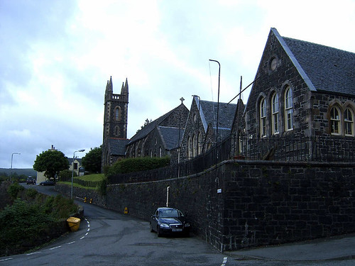
Multi-displinary arts centre based in Tobermory in what looks like old school. Live Gigs and stream of activities. Well worth visit.
Mull Eagle Watch Hide
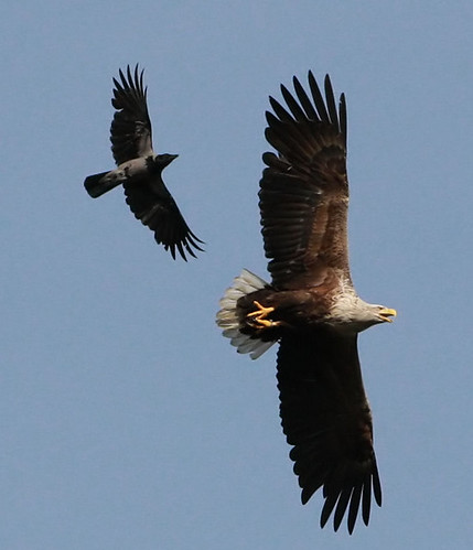
Exciting partnership between a number of different local organisations including the RSPB that provides visitors with a chance to see Mull's fantastic Sea Eagles and Golden Eagles
-
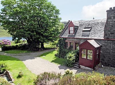
Achnadrish House Self Catering sleeps 8
Situated on the beautiful and wild Isle of Mull on Scotland's West Coast, Achnadrish House, dates back more than 200 years.
- Sleeps: 8
-
Rowan cottage self catering holiday sleeps 4
Rowan cottage is conveniently situated in the heart of the island of Mull within the village of Salen. A perfect accommodation option to explore Mull`s unspoilt scenery and heritage.
- Sleeps: 4
-
East Muntloch Croft Isle of Mull sleeps 4
East Muntloch Croft, a friendly B & B is an excellent retreat in the country with outstanding views to the Mull of Galloway, Sea and Isle of Man on clear day.
- Sleeps: 4
-
The West Wing of Achnadrish house sleeps 6
The West Wing of Achnadrish house, originally housed the servants of the house still retains a historical charm.
- Sleeps: 6
-
The White Cabin of Achnadrish Home sleeps 2
The White Cabin was originally built for the housekeeper of Achnadrish and is refurbished with new carpets, curtains, and kitchen.
- Sleeps: 2
-
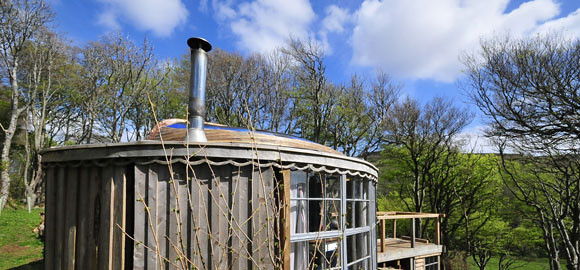
Kittiwake Camping Hut
Small and rather romantic hut in Calgary Bay on the island of Mull in the Inner Hebrides. Sleeps 2 in double. No electricity etc. Remote & Lovely!
- Sleeps: 2
Other Cottages
-

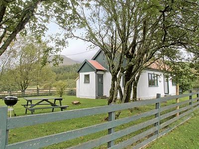
Sunset Cottage on Mull East Coast - Sleeps 4
Modern cottage on the east coast of Mull midway between Salen & Craignure at Fishnish. Sleeps four people in two bedrooms. -

Driftwood Cottage in Salen Isle of Mull - sleeps 4
Modern ground floor cottage, six miles from Salen on the Isle of Mull. Sleeps four people in two bedrooms.
-
Shepherd's Cottage, Pennyghael, Mull - Sleeps 5-6
The Pennyghael Estate covers approx. 8500 acres, stretching from the shores of Loch Scridain southwards to the sea cliffs at Carsaig, overlooking Jura, Islay and Colonsay, and westwards for 5 miles .... -
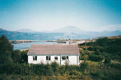
Corry House, Craignure, Isle of Mull - Sleeps 8/9
Offering panoramic views across the Sound of Mull, this beautiful, modern-designed house is situated in a perfect location. In an area with breathtaking scenery and stunning sea and mountain views -
But 'n Ben, Isle of Mull - Sleeps 4
On the sheltered south-east coast of Mull, between Craignure and Iona and overlooking the River Lussa and Loch Spelve, these three wonderful properties enjoy a glorious secluded position within the 4,000-a... -
Ardura Cottage, Mull, Sleeps 4
On the sheltered south-east coast of Mull, between Craignure and Iona and overlooking the River Lussa and Loch Spelve, these three wonderful properties enjoy a glorious secluded position within the 4,000-a... -
Craig Ben Cottage, Isle of Mull, Sleeps 6-8
Craig Barn Lodge and Cottage are situated in an outstanding and beautiful area, affording stunning views over the beautiful and tranquil Loch Uisg. In a remote setting, surrounded by wooded glens and rugge... -
Torrans Cottage, Pennyghael, Isle of Mull - Sleeps 5/6
The Pennyghael Estate covers approx. 10,000 acres, stretching from the shores of Loch Scridain southwards to the sea cliffs at Carsaig, overlooking Jura, Islay and Colonsay, and westwards for 5 miles ..