Walks around Ullapool
A set of good walks around Ullapool in North West Scotland.
There are several good walking trails which start in Ullapool. One of these is to the top of Ullapool Hill, or Meall Mhor (886 ft). Starting from the tourist office, head to the end of Argyle Street, turn left on to North Road and then cross the road at the Far Isles Restaurant. Walk down the lane between Broom Court and the Hydro sub-station and then follow the path which zig-zags up the hillside. There's a good cairned path up to the top of the hill. The views from the top over Glen Achall, and on a clear day, the mountains of Sutherland, are superb. You can return by traversing the hillside to the top of the Braes, or take a track leading to Loch Achall and follow the Ullapool river through the quarry road back to the village. The return trip takes one to two hours.
A relatively easy, but much longer walk, of five to six hours, is to Rhidorroch Estate. Take the A835 north out of Ullapool. Opposite the petrol station and before the bridge, take the road on the right signed 'Quarry'. Go through the quarry keeping to the left, and follow the Ullapool river till you see Loch Achall. Continue along the north bank of the loch for another six miles. East Rhidorroch Lodge is on the right; cross the bridge to get there, then skirt the lodge fences and cross to the track which leads up the southwestern hill. This brings you out to Leckmelm, about four miles south of Ullapool on the A835. This last section offers wonderful views across Loch Broom to An Teallach. From Leckmelm you can also climb Beinn Eilideach (1,837 ft).
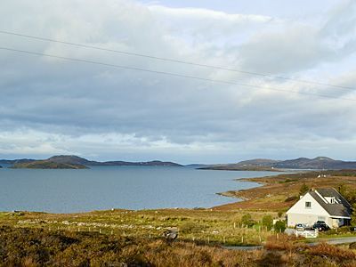
A good coastal walk is to Rhue Lighthouse and back. From the north end of Quay Street go down the steps to the river. Cross the bridges and head left by the football field. Follow the path to the left by the duck pond and cross in front of the bungalow. Then follow the shoreline north for about two miles, climbing up the hillside when the tide is high. Follow the path till you reach the little white lighthouse at Rhue Point. To return, take the single-track road out of Rhue back to the main road and up over the hill to Ullapool. It's about six miles in total.
There are many more strenuous hiking routes around Ullapool. The A835 south of town gives access to Beinn DeargBeinn Dearg (3,556 ft) and the Fannichs, a range of hills on the southern side of Dirrie More. There's also An Teallach, a favourite with Scottish climbers. North of Ullapool are the mountains within the Inverpolly National Nature Reserve. These include Ben Mór CoigachBen Mór Coigach (2,438 ft), Stac PollaidhStac Pollaidh (2,011 ft), Cul BeagCul Beag (2,523 ft) and Cul MórCul Mór (2,786 ft).
All routes are covered by OS Maps Nos 15, 19 and 20. They all require hillwalking experience and you should be well prepared for the unpredictable weather conditions. A good climbing guidebook is The Northern Highlands, SMC District Guide, by Tom Strang. North West Frontiers is an Ullapool-based tour company offering guided walking tours around Ullapool and throughout the Northwest Highlands. Contact them at: 18A Braes, Ullapool, IV26 2SZ, Tel./Fax. 612628, This email address is being protected from spambots. You need JavaScript enabled to view it., ourworld.compuserve.com/ homepages/NWF
Difficulty Level
ModerateOrdnance Survey
15,19, 20Other Cottages
-

Ardvreck Terraced House Ullapool - Sleeps 6
Traditional terraced house in centre of Ullapool in Wester Ross. Sleeps six people in three bedrooms. -

Sail Mhor Cottage near Dundonnell - Sleeps 8
Detached cottage close to Laide on coastal route between Poolewe and Ullapool. Sleeps eight people in four bedrooms. -
Conival, nr Ullapool - Sleeps 9
With one of the best locations in the area, this spacious and modern property commands stunning panoramic sea and island views and is ideal for a large group or for semi-independent use by two families hol... -

Duncaan Oliday House near Applecross - Sleeps 6
Nestled between the mountains and the sea, lovely whitewashed house with awesome views in a truly beautiful part of scotland. Sleeps 6 in 3 bedrooms. No Dogs. No Wifi. -

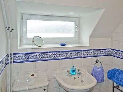
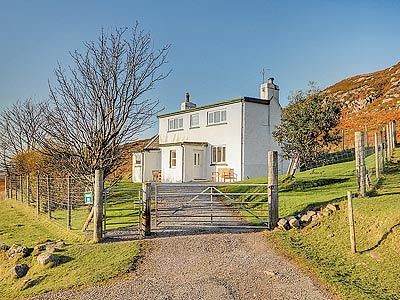
Fisherman's Cottage near Ullapool - Sleeps 5
Smart, detached, ground floor cottage situated on a private, family-owned estate, six miles North of Ullapool. Sleeps five people in three bedrooms. -

Coast House Cottage in Laide - Sleeps 6
Lovely cottage situated in a quiet location, near the village of Laide in Wester Ross. Sleeps six people in three bedrooms.
-
St Enodoc Cottage, Ullapool - Sleeps 4
Exuding great charm and character, this traditional holiday cottage is set within the bustling town of Ullapool, on the shores of Loch Broom. Commanding marvellous panoramic sea views which stretch towards... -
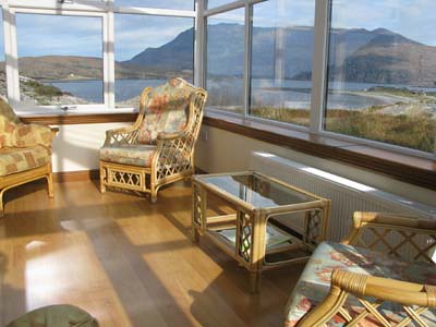
Ardmair House, nr Ullapool - Sleeps 6
This modern house, built in the traditional Scottish style, has uninterrupted views across Ardmair Bay to the distant Summer Isles. The conservatory allows the visitor to take full advantage of the .... -
Ceol-na-Mara, Western Highlands - Sleeps 6
Camuasnagaul is a tiny hamlet of crofts a few miles along the coastal road from Dundonnell in Wester Ross, Ullapool 24 miles. Nestling peacefully on the shore line of Loch Broom, this detached cottage enjo... -
Badger's Den, Inverpolly - Sleeps 4
Situated on the edge of a hillside, amongst wild highland landscape with only the deer and foxes close by. This traditional highland cottage provides a perfect holiday retreat to relax and unwind from the ...