Dun Athad
Originally an Iron Age Dun, now ruined. Also called Dunaidh Castle. Much ruined, but amazing location.
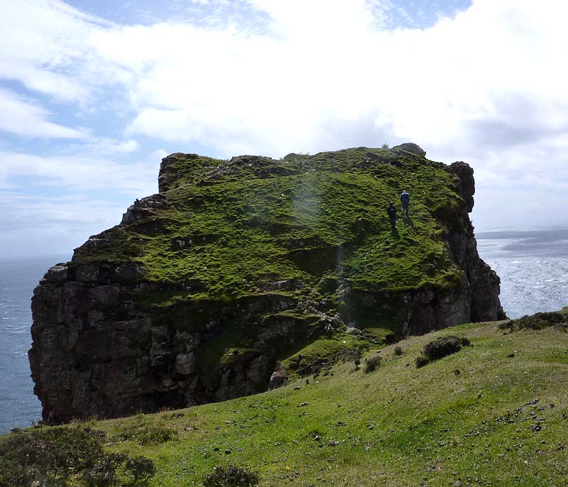


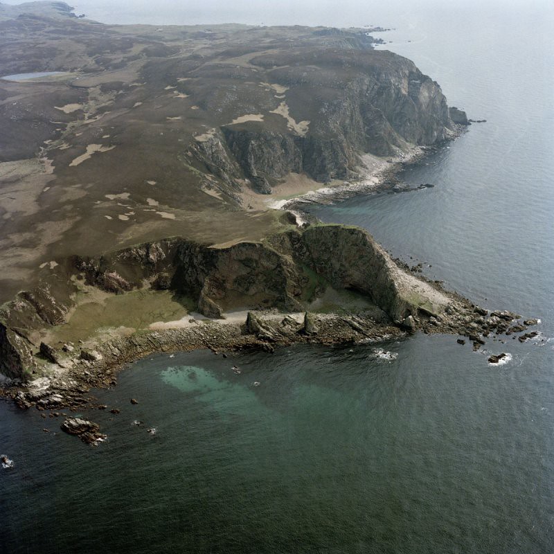


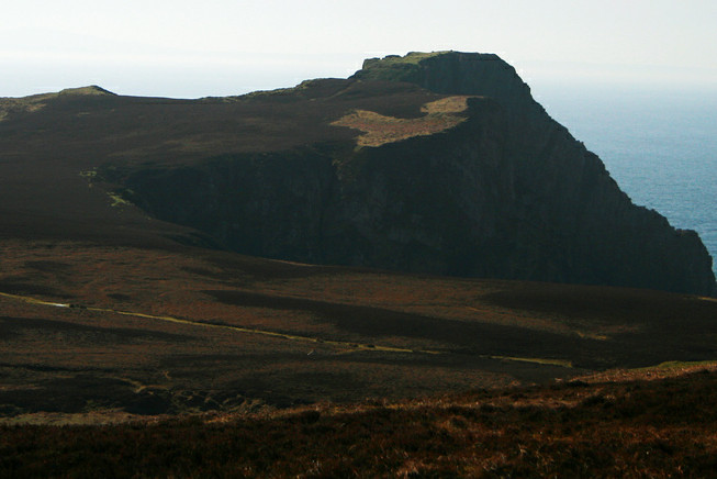


These remains occupy the summit of a large and impressive coastal promontory which is situated about 2 km SE of the
Mull of Oa. The position is one of considerable natural strength and commands an extensive prospect as far as the
Antrim coast and the Mull ofKintyre. Rocky cliffs rise sheer on each flank of the promontory to a height of over 105m
and the summit-area is an irregular linear platform measuring 90m in maximum extent from NE to SW and
varying in width from 6m to 23m. The approach from the landward or NE side is across a narrow neck of land about 2m
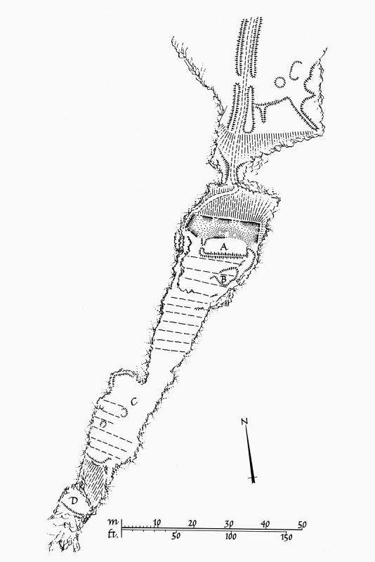
in minimum width, and thence obliquely by a sloping ascent along the W edge of the main ridge, skirting the remains of a massive forework. The forework, which measures 17.8m in length from E to W and is returned at each end, has a well-defined outer kerb of facing-stones, but is otherwise reduced to a bank of stony debris some 5.8m in maximum
ascertainable thickness. The rubble core of this wall contains the remains of one (and possibly a second) small circular hut of intramural construction. It may have served as an annexe to building a which lies behind the forework. This building is of rectangular plan and measures 11m in length from E to W by 3m transversely within low turf-covered walls; the entrance is located in the W end-wall. Building or enclosure B (RCAHMS 1984 plan) is of roughly ovoid plan measuring 5m in maximum length from E to W within low scarped banks; it has an entrance in the W sector and is partly overlaid by rigs. Structures A and B lie within a relatively sheltered and hollowed interior circumscribed by traces of a dyke and upstanding rock-cut walls. The remainder of the summit is a narrow and exposed plateau which contains much evidence of rig-cultivation, and retains portions of turf dykes along the W flank and the SW boundary. A short distance down the rocky sw slope there is a level grassy platform (D) which also incorporates the remains of an outer turf bank. The oval depression at C possibly marks the site of a well or cistern for the supply of fresh water.
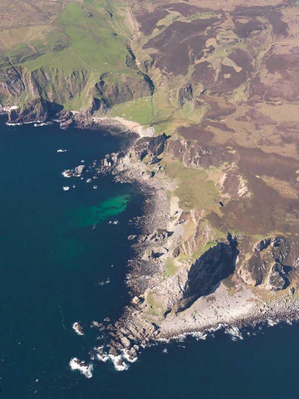
The approach track across the adjacent headland is flanked by turf banks, and there are traces of other field-banks and structures on the E side of the headland. On the boulder-strewn foreshore around the base of the promontory
there are a number of rock-shelters and caves, some of which are fronted by enclosure-walls of boulder construction. One of the caves contains deposits of manganese ore.
The natural advantages of this site may have invited fortification from prehistoric or Early Historic times, but the
existing defences and associated buildings appear to date from an otherwise unrecorded refortification of the 16th or
early 17th century. It may have served as one of the beacon-stances used by the supporters of Sir James MacDonald in
1615. A slightly later topographical account refers to the 'great fortress called Dunaynt,' which with 'small expensis
. . might be maid ane Invincible strength'. (Geog Coll)
RCAHMS 1984, visited May 1978.
Opening Times
Open to view but dangerous to walk around except with care
Related Clans
MacDonaldTravel Directions to Dun Athad
Travel Directions
6 miles South west of Port Ellen on far South western tip of Islay. Minor Road off A846. You wiull need to walk across fields to access. Amazing location
Visitor Attractions
-

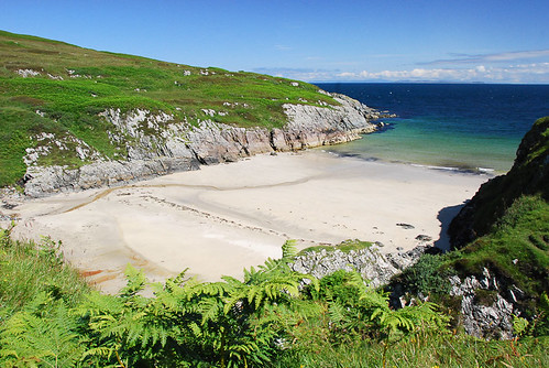
Saligo Beach on Islay
Many people's favourite beach on Islay and often dramatic seas which make wonderful in any weather. Walk across dunes to access